What Is Remote Sensing and Its Applications?
What Is Remote Sensing and Its Applications?
Remote that means something which is not exactly in contact or physical contact, Sensing means getting information, data something like temperature, pressure, photograph, etc.
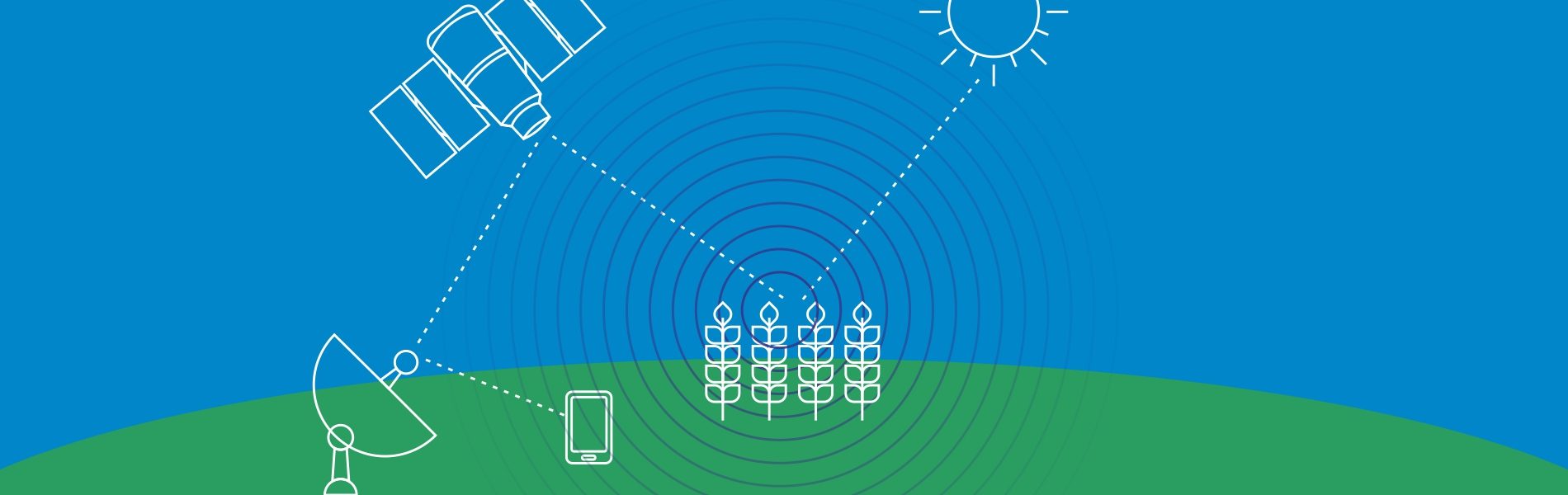
Remote sensing is the process of acquiring information, detecting, analyzing, monitoring the physical characteristics of an area by recording it is reflected and emitted radiation energy without having any physical contact with the object under study. This is done by capturing the reflected radiation/energy.
Types of remote sensing
1. Active sensor
The sensor embodies within itself the source of illumination like a satellite equipped with a RADAR sensor. Active sensors throw their own energy to scan the object. RADAR and LiDAR are examples of active remote sensing which measure the time delay between emission and return.
2. Passive sensor
The sensors gather radiation that is emitted or reflected by the object or surrounding areas. Sunlight reflection is the most common source of radiation measured by passive sensors. Examples of passive remote sensors are photography, infrared, and radiometers. Passive sensors are more used because it provides great quality satellite imagery. The passive sensor is superior within the field of technical observation of the planet, such as Multispectral and Hyperspectral technology.
Spectral reflectance in remote sensing
Land-cover and land-use maps are required for many applications such as regions planning, landscape planning, and landscape ecology, agricultural management, and forestry.
Electromagnetic energy reaching the earth’s surface from the Sun is reflected, absorbed or transmitted. A basic assumption made in remote sensing is that specific study targets (different types of soils, water having different degrees of impurities, rocks of different lithologies, or vegetation of various species) have an individual and characteristic manner of interacting with incident radiation that is described by the spectral response of that study target.
The spectral reflectance can be affected by many factors such as soil nutrients, the growth stage of the vegetation, the color of the soil (which may be affected by recent weather conditions).
In some instances, the interaction between incident radiation and earth’s surface object will be different from time to time, such as might be expected in the case of vegetation as it changes from the leafing stage, through maturity growth and, finally to senescence. The term ‘spectral signature’ is sometimes used to describe the spectral response curve for a study target.
Remote Sensing Major Applications Area
Satellites play a huge role in the development of many technologies like world mapping, GPS, City planning, etc. Remote Sensing is one of the many innovations that were possible, thanks to the satellites roaming around the earth.
Following are some major fields in what can remote sensing be used for
- Weather
- Forestry
- Agriculture
- Surface changes
- Biodiversity
And many more (the number is damn high, can’t list out all, these are the main fields in which it is mostly used)
The primary application of remote sensing?
-
Analyzing the condition of rural roads
Rural road conditions are now possible to be analyzed using various GIS technique and Remote Sensing techniques with an inch to inch accuracy. It saves a lot of time and money from transporters.
-
Creating a base map for visual reference
Nowadays many modern mapping technologies are based on Remote Sensing including Google maps, open street maps, Bing maps, NASA’s Globe view, etc.
-
Computing snow pack
Snow melt ratio can be easily understood by using Remote Sensing technology, NASA uses LIDAR along with a spectrometer in order to measure the absorption of sunlight.
-
Collecting earth’s pictures from space
Many space organization has a collection containing images of earth. Interesting patterns of earth’s geometry including atmosphere, oceans, land, etc can be seen in it. EO-1, Terra, and Landsat are used to collect this data.
-
Controlling forest fires
Information acquired by satellites using Remote Sensing enables firefighters to be dispatched on time and over correct locations so the damage from such fires can be decreased to minimal.
-
Detecting land use and land cover
Remote Sensing technologies are used to determine various physical properties of land and also what it is being used for (land use).
-
Estimating forest supplies
MODIS, AVHRR, and SPOT are regularly used to measure the increment/decrement in global forests since forests are the source of valuable materials such as paper, packaging, construction materials, etc.\
-
Locating construction and building alteration
Tax revenue agencies use satellite data in several countries including Greece, Athens, etc. They locate signs of wealth using this technology. Early in the year of 2013, there were 15000 swimming pools (unclaimed to steal taxes) in those countries.
-
Figuring out fraud insurance claims
Many insurance companies use Landsat’s red and infrared channels to figure out vegetation growth in particular land. This information can be used to verify seeded crops and fight against crop insurance fraud.
-
Observing climate changes
Satellites such as CERES, MODIS, AMSRE, TRMM, and MOPITT has made it possible to observe climate changes from up above the skies. It is also possible to compare past climate situation with the current one.
-
Predicting potential landslides
Landslides cause noticeable death and wealth loss around the globe. INSAR uses interferometry remote sensing technique for providing an early warning regarding potential landslides.
Application of remote sensing in agriculture?
-
Identifying crop conditions
Satellite imagery and normalized difference vegetation index(NDVI) technologies are used in order to monitor global food supplies. Healthy crops area reflect green where other areas reflect red or blue.
-
Increasing precision in farming
The health of crops can be measured using remote sensing applications so that almost 10 percent of fertilizer, money and time can be saved.
-
Determining the soil moisture content
Active and passive sensors of a satellite in space are used in order to determine soil moisture content. Many earth sciences such as water cycle, flood, and drought are based on the content of soil moisture.
-
Crop production forecasting
Remote Sensing is used to predicting crop production and yield over a given field and determine how much of the crop will be harvested under the specific conditions. The researcher can predict the crop quantity that will be produced in given farmland over a given period of time.
-
Determining crop damage and crop progress
In the event of crop damage or crop progress, remote sensing technology can be used to penetrate the farmland and determine exactly how much of a given crop has been damaged or under stress and the progress of the remaining crop in the farm.
-
Crop Identification
The crop can also be identified using remote sensing technology especially in cases where the crop under observation is mysterious or shows some mysterious characteristics. The data of the crop is collected and taken to the labs where various aspects of the crop including the crop culture are studied.
-
Crop condition analysis and stress detection
Remote sensing technology plays an important role in the assessment of the crop health condition and the extent to which the crop has withstood stress. This data can be then used to determine the quality of the crop.
-
Drought Monitoring
Remote sensing technology is used to monitor the weather patterns including the drought patterns over a given area. The information is used to forecast the rainfall patterns of an area and also tell the time difference between the current and the next rainfall which can be helpful to keep track of the drought.
-
Water content determination of the field crop
Apart from determining the soil moisture content, remote sensing also plays an important role in the estimation of the water content in the field crops.
-
Crop health analysis
Health analysis of a crop can be also determined which helps in determining the overall crop yield.